Artist:
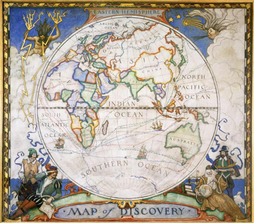
N.C. Wyeth
(American, 1882 - 1945)
Map of Discovery--Eastern Hemisphere
Medium: Oil on canvas
Date: 1927
Dimensions:
104 × 117 in. (264.2 × 297.2 cm)
National Geographic Society
Accession number: SUPP2000.999
Research Number: NCW: 999
InscribedLower left: N. C. WYETH / 1927
References
Special Color Supplement, National Geographic Magazine, vol. LIV, no. 1 (Nov. 1928); illustration in b/w, p. 14, "An Invitation to Explore," souvenir book of the National Geographic Society, Washington, 1933(?); Douglas Allen and Douglas Allen, Jr., N.C. Wyeth, The Collected Paintings, Illustrations and Murals (New York: Crown Publishers, 1972), ps. 162, 267, illustration in b/w, p. 168; Christine B. Podmaniczky, N. C. Wyeth, A Catalogue Raisonné of Paintings (London: Scala, 2008), M.37, p. 615
Curatorial RemarksFor the positions in the stairway held by the two maps, Wyeth originally proposed tributes to Alexander Graham Bell and Robert Perry. But he quickly decided that these subjects were too important for the secondary positions and suggested Mercator projections instead. "Intrinsically these will be extremely decorative, and futhermore will play a beautiful obligato as it were, to the other three panels (NCW to John Oliver LaGorce, June 16, 1926, National Geographic Society, Washington, DC). The Society's president Gilbert Grosvenor, however, preferred designs based on 16th century mariners' maps (JOlaG to NCW, June 25, 1926, NGS). The entire commission was completed by mid-October. (NCW to Andrew N. Wyeth, Oct. 20, 1927, Wyeth Family Archives).
"The second map (Eastern Hemisphere) is nearing completion. It is, I believe, better designed and executed than the first one. I am quite pleased with the results and certainly have learned a lot about pure decoration. I do wish I had the time to exhibit these as they would create a lot of interest I think" (NCW to ANW, Sept. 23, 1927, WFA). According to a letter to his father dated in another hand September 30, 1927, both maps were complete at that time; "it only remains for me to varnish them and ship when the word is given."
;Wyeth sent a smaller version of this design and the Map of Discovery--Western Hemisphere to exhibition at the Wilmington Society of the Fine Arts in November 1928. Described in the exhibition brochure as "Miniature reproductions of Decorative Maps made for the Hubbard Memorial Building, Washington, DC" (number 101 A & B), it is not clear if these were the presentation paintings shown to members of the National Geographic Society or the reproductions of the maps that had been printed and distributed in the November1928 and January 1929 issues of the National Geographic Magazine. A review of the exhibition in the Wilmington Morning News (Nov. 15, 1928, pg. 1) lists "the quaint "Maps of Discovery" looking mellow with age, that now adorn the walls of the building of the National Geographic Society" as among Wyeth's offerings.
Image Source for printed Catalogue Raisonne:Photography directly from artwork
Photo Credit:Victor R. Boswell, Jr. / National Geographic Image Collection